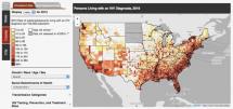
eHealthmap.com
This site was developed to help public health professionals who need to utilize GIS technology as part of their daily research activities. With many available functions to view, understand, question, interpret, and visualize data, researchers utilize GIS for disease surveillance, data collection, and data visualization.The site addresses how GIS is continually used in healthy research and promotion such as disease surveillance, community health projects, or other research projects which it has encountered.
Source: Vertices, LLC
Date of Publication: March 25, 2019
SIMILIAR RESOURCES
Tools
Examples
- Promoting Quality Malaria Medicines Through SBCC: An Implementation Kit
- A Guide to WHO’s Guidance on COVID-19
- Social and Behavior Change Considerations for Areas Transitioning from High and Moderate to Low, Very Low and Zero Malaria Transmission
- International COVID-19 Awareness and Responses Evaluation Study
- COVID-19, Maternal and Child Health, and Nutrition
- Physical Distancing, Face Masks, and Eye Protection for Prevention of COVID-19
- Unpacking the Root Causes and Consequences of Vaccine Hesitancy
- COVID-19 Vaccine Introduction Toolkit
- Early Estimates of the Indirect Effects of the COVID-19 Pandemic on Maternal and Child Mortality in Low-income and Middle-income Countries: a Modelling Study
- Guidance for Including People with Disabilities in Response to the COVID-19 Pandemic

